
Description
A comprehensive road atlas for traveling in Austria
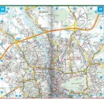
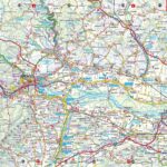
The Freytag & Berndt Austria Road Atlas is a very practical tool for planning a trip across the country. Thanks to its detailed 1:150,000 scale mapping, it allows you to visualize main roads, secondary roads, towns, valleys, mountain passes, and major tourist routes.
It is suitable for car travelers as well as road trip enthusiasts, campervan travelers, and cyclists.
Its atlas format allows you to maintain an overview while precisely planning your itinerary.
Therefore, it is ideal for organizing a road trip in Austria, between the Alps, lakes, valleys, historic towns, and border regions.
Austria, leisure activities, camping, and cycling routes
This atlas is not limited to roads. It also includes practical information for travelers: campsites, parking areas, leisure destinations, city maps, and a place name index.
Furthermore, it provides brief information on several Austrian cycling routes. These include classics such as the Danube Cycle Route and the Tauern Cycle Route. It is therefore a valuable resource for identifying major cycling routes and planning a trip combining road cycling, nature, and cycling.
The atlas also covers useful areas around Austria, with supplementary maps for some neighboring regions. This facilitates cross-border journeys from Germany, Italy, Slovenia, Hungary, the Czech Republic, or Slovakia.
A reliable tool for planning your stages
With its detailed maps, index, and city maps, this atlas helps you create a coherent itinerary. It allows you to identify distances, access points, main roads, and rest stops.
It is particularly useful for travelers who like to keep a printed guide in their vehicle. As a complement to a GPS, it offers a broader view of the region and allows you to better plan your stages.
Finally, the information related to camping, leisure activities, and cycling routes makes it a versatile atlas, ideal for active holidays in Austria.
Atlas Highlights:
- Large road atlas of Austria
- Detailed 1:150,000 scale mapping
- Ideal for cars, campervans, and planning cycling routes
- Information on campsites and parking areas
- 100 leisure destinations featured
- Short descriptions of several cycling routes
- Includes the Danube Cycle Route and the Tauern Cycle Route
- Maps of Austrian regional capitals
- Austria planning map
- 1:3.5 million map of Europe
- Index of towns and villages
- Practical support for use with a GPS
FAQ
What area does this atlas cover?
This atlas covers all of Austria, with detailed road maps and supplementary maps for some neighboring regions.
What is the scale of the atlas?
The main scale is 1:150,000, suitable for planning road trips and tourist itineraries.
Is the atlas useful for a campervan trip?
Yes. It includes information on campsites and parking areas, making it practical for van and campervan travelers.
Can it be used to plan a cycling trip?
Yes. The atlas includes several Austrian cycling routes, including the Danube Cycle Route and the Tauern Cycle Route. For precise cycling, it can be supplemented with dedicated cycling maps.
Does this atlas replace a GPS?
No. It complements a GPS very well. It primarily allows you to maintain an overview of the country, plan your stages, and anticipate your journeys.
Features
Name
Austrian Tourist Atlas - Freytag & Berndt 1:150,000
Weight
11 kg
Language
German
This might interest you

Similar Products
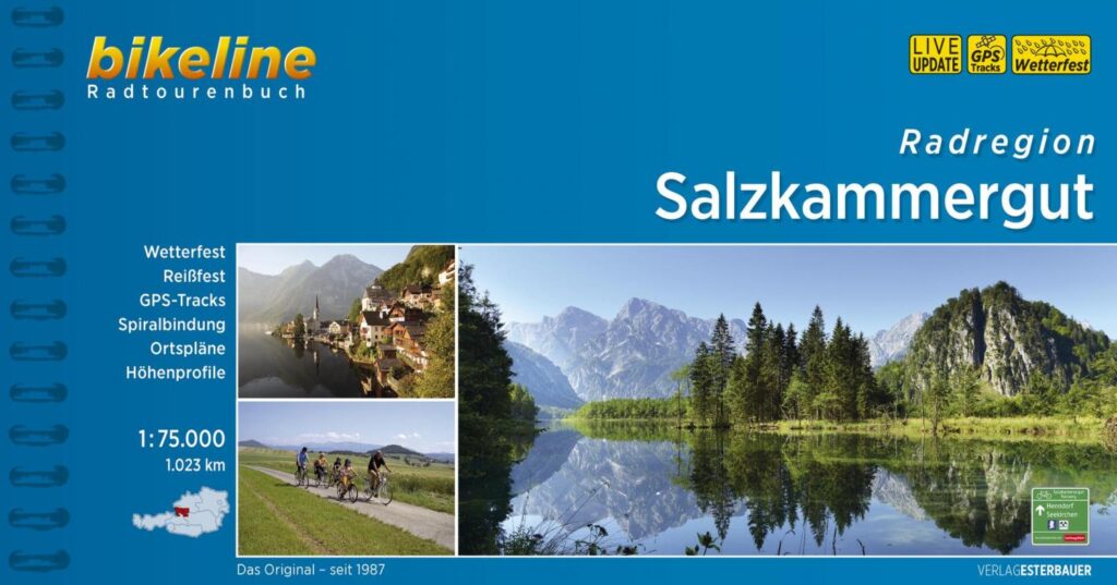
Guide vélo région Salzkammergut - Autriche
Cycling guide to the Salzkammergut region in Austria with 1023 km of routes and 1/75 000 scale maps and GPS tracks.
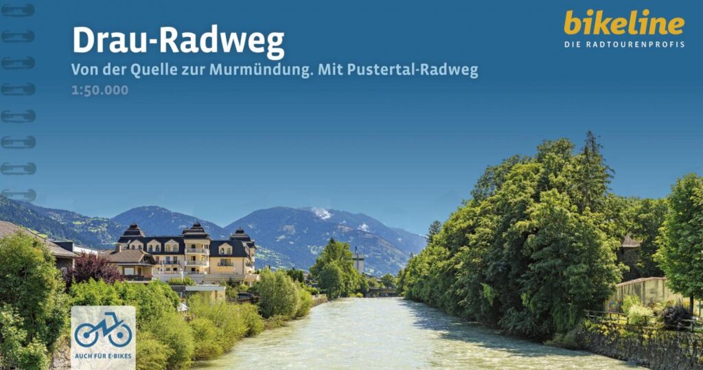
Drau-radweg
Bikeline cycling guide to the Drau cycle path in Austria, Croatia, Italy and Slovenia, with 508 km of itinerary and 58 maps at 1:50,0000 scale.