Hiking guides and maps in Reunion Island
Hiking on Reunion Island
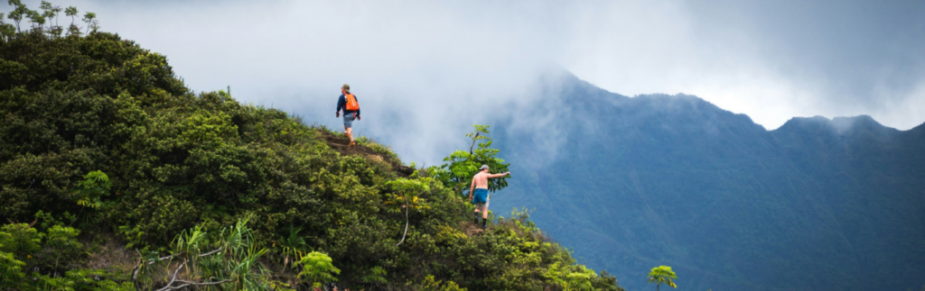
Hiking on this vibrant island means discovering a unique territory. From the lunar volcanic landscapes of Piton de la Fournaise to the rugged cirques of Mafate, Cilaos, and Salazie, hiking in Reunion Island is an unforgettable experience for lovers of wild nature and spectacular panoramas.
Accessible to all levels, hiking in Réunion offers a diversity of trails and landscapes that will delight families looking for an easy Réunion hike as well as seasoned hikers dreaming of reaching the highest peaks.
Discover Reunion Island on foot
Listed as a UNESCO World Heritage Site for its “Pitons, Cirques and Ramparts”, Réunion is a hiker’s paradise. The island is distinguished by its exceptionally rich landscapes :
- The natural cirques of Mafate, Cilaos, and Salazie, veritable natural amphitheaters sculpted by erosion.
- Piton des Neiges, the highest peak in the Indian Ocean (3,070 m).
- Piton de la Fournaise, an active volcano accessible to hikers.
- Primitive forests, majestic waterfalls like Trou de Fer, sugarcane fields, and typical Creole villages.
Every hike in Reunion Island is an immersion in preserved biodiversity and a mixed culture, inherited from the island’s turbulent history.
The most beautiful hiking trails in Reunion Island
Here are some of the most beautiful hikes in Reunion Island that you can discover with the help of suitable guides and maps:
- The Cirque de Mafate (GR® R1) : Accessible only on foot or by helicopter, Mafate is the jewel of Reunion Island’s hiking scene. Trails connect isolated islets and timeless villages in a spectacular setting.
- The Piton de la Fournaise : The iconic ascent of the Piton de la Fournaise immerses you in a landscape of lava and craters. A hike not to be missed, both easily accessible and impressive.
- The Cirque de Cilaos (GR® R2) : Known for its thermal baths and lentils, the Cilaos hike offers numerous trails offering breathtaking panoramas.
- The Cirque de Salazie : Less frequented but equally magnificent, Salazie is the kingdom of waterfalls. A Salazie hike will take you through lush nature to charming villages like Hell-Bourg.
- Trou de Fer via Bélouve : A must-see to admire one of the highest waterfalls in the world, in the heart of a fascinating primary forest.
For an easy hike in Reunion, there are also many marked trails that allow you to enjoy the island without any major difficulty, particularly in the Hauts or on the coast.
Essential products for hiking in Reunion Island
Here are some guides and maps that you absolutely must take with you for a successful adventure:
- Reunion Island Guide, the Most Beautiful Hikes : Rother Hiking Guide on the island, a hiker’s paradise with 55 downloadable routes and GPS tracks.
- Topoguide tours and crossings of Reunion Island : 23 days of backpacking along marked trails. This topoguide highlights the three long-distance hiking trails (GR®) that cross the island inland.
The hiking network in Reunion, trails to preserve
Hiking on Reunion Island is possible thanks to an exceptional network of marked trails:
- Over 1,000 km of Grande Randonnée (GR®) trails maintained by the ONF (National Forestry Office) and local authorities.
- Hundreds of kilometers of local loops suitable for all levels.
- Forest roads accessible on foot in the upper reaches of the island.
However, extreme weather conditions and the terrain make some trails vulnerable to adverse weather conditions, particularly during cyclones or heavy rain. Temporary closures may be decided for safety reasons.
Before hiking in Réunion, always check trail conditions on the ONF Réunion website (www.onf.fr) or the official prefectural decree page. A closed trail indicates danger, even if it is not visible.
Hiking safety in Réunion is a priority: use mountain guides for certain technical hikes or if you are unfamiliar with the island’s unique features.