
Hiking guides and maps on the GR®653
GR®653 – Arles Route
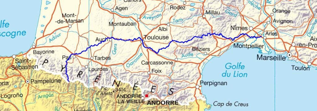
The GR®653, known as the Arles Way, is one of the major routes on the Camino de Santiago. It connects the Mediterranean coast to the Pyrenees mountain range, crossing a mosaic of landscapes and towns steeped in history.
GR®653, the route from Arles to Compostela, between the Mediterranean and the Pyrenees
The Arles Way of St. James, or GR 653, is a fantastic hiking adventure that connects Arles to Jaca, Spain, via Toulouse and the Atlantic Pyrenees. This long-distance hiking trail crosses around ten departments and covers over 800 km of walking through diverse landscapes, including scrubland, valleys, and high mountains.
Starting in Arles, the Arles Way winds through Languedoc, Tarn, Aveyron, and Haute-Garonne, reaching the Aspe Valley in the Pyrenees. The route follows ancient paths, runs alongside clear rivers, and crosses the Séranne, Escandorgue, Espinouse, and Somail mountain ranges. The Somport Pass, at an altitude of 1,632 m, marks the entrance to Spain and the junction with the famous Camino Francés.
The Arles Way is generally less traveled than the other pilgrimage routes, but that doesn’t make it any easier. The difficulties of the Arles Way are mainly due to the length of the stages, the sparsely populated areas, and the crossing of the Pyrenees at the end of the route. The elevation gain is slight at the beginning until Toulouse, but significant between the Gers and the Col du Somport.
It is advisable to adapt your stages according to your physical condition, especially in the mountains. Using a porterage service or a guide may be advisable on certain sections. A map of the Arles Way or a GR 653 guidebook is essential for properly planning your itinerary. These tools allow you to precisely follow the GR 653 route, locate accommodations, water points, and elevation changes, and adapt your route to your abilities.
What to see on the GR®653 ? A rich route
Here are some must-see places and stops along the Arles route:
- Aspe Valley and Somport Pass : Alpine landscapes and magnificent panoramas.
- Saint-Gilles : Its UNESCO-listed abbey, a major historical landmark.
- Saint-Guilhem-le-Désert : A medieval gem nestled in the Hérault gorges.
- Lodève : A city of art and history with cobbled streets and surprising museums.
- Haut-Languedoc Natural Park : Vast forests, lakes, and wildlife.
- Toulouse : The “Pink City,” a lively urban stopover with a rich heritage.
Hiking this trail combines nature, culture, and spirituality. You pass from Mediterranean scents to pastoral valleys, from hilltop villages to large Occitan cities.
Routes connected to the GR®653
The GR®653 crosses or connects with other major routes to Santiago de Compostela:
- GR®65 – Via Podiensis: via Le Puy-en-Velay, it joins the Camino Francés at Saint-Jean-Pied-de-Port.
- GR®654 – Via Lemovicensis: starts in Vézelay and joins the GR 65 at Montréal-du-Gers.
- GR®655 – Via Turonensis: via Tours, Bordeaux, then Ostabat.
These connections allow you to customize your itinerary or complete several sections over the years. Don’t hesitate to visit our Camino de Santiago page.