Hiking guides and maps in Provence-Alpes-Côte d’Azur
Hiking in Provence-Alpes-Côte d’Azur
From hiking in the Alps to the coastal trails of the Mediterranean, the Provence-Alpes-Côte d’Azur region offers a diverse landscape. Between blooming lavender fields, dizzying gorges, and turquoise coves…
Discover the Provence-Alpes-Côte d’Azur region on foot
Hiking in the PACA region means traversing diverse landscapes. The region is home to some of France’s most renowned natural gems: the Écrins National Park, the Verdon Gorges, the Calanques de Marseille, and the hilltop villages of the Luberon.
Hiking enthusiasts in the Verdon enjoy the majesty of the canyon, the largest in Europe, and the emerald waters of Lake Sainte-Croix. Those who prefer the sea can hike along the white cliffs of the calanques or the secret coves of the Var. Hiking on the Côte d’Azur promises an immersion between beaches, pine forests, and panoramic ledges.
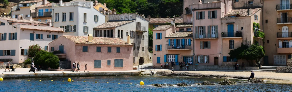
In terms of heritage, emblematic cities like Marseille, Avignon, Nice and Aix-en-Provence punctuate the itineraries with cultural stops: old districts, listed monuments, Provençal markets… A real pleasure to combine walking and discovery.
The great hiking routes in PACA
The region is crisscrossed by several of France’s most iconic Grande Randonnée (GR®) trails. Here is a selection of the most notable:
- GR® 4 From Grasse to the Verdon Gorges : This trail connects the Atlantic to the Mediterranean. In the Provence-Alpes-Côte d’Azur region, it crosses the Grasse hinterland, the lavender plateaus of Valensole, the famous Verdon Gorges, and the Luberon Natural Park. A magnificent journey through the heart of the Provençal landscapes.
- GR® 6 Between the Provençal Alps and the Luberon : From the village of Saint-Paul-sur-Ubaye to Arcachon, this route takes you through the Southern Alps, the Luberon, the Alpilles, and the Cévennes. It is one of the most varied routes in France, ideal for hiking in the Southern Alps.
- GR® 9 From the Jura to the Mediterranean : After crossing the Vercors and Drôme, this trail reaches Provence via Mont Ventoux, Sainte-Victoire, and the Var massifs. It offers a beautiful immersion in the region’s limestone landscapes.
- GR® 653 Arles Way : This Way of St. James crosses Provence from east to west, following the ancient Roman road. From Arles to the Hautes-Alpes, it passes cliffs, scrubland, Romanesque abbeys, and hilltop villages.
These marked routes also offer numerous GR® de Pays and PR® variations, perfect for a hike around Aix-en-Provence or a loop of a few days in the Luberon.
The essentials for hiking in PACA
Here are some essential tools to pack in your backpack before hitting the region’s trails:
- Topoguide to the Luberon Regional Natural Park on foot: 31 walks and hikes in the Natural Park are described in this FFRandonnée topoguide.
- IGN map of the Alpes-Maritimes: To plan your trip to the Alpes-Maritimes region around Nice, the Côte d’Azur, and the Mercantour National Park.
- Rother’s Provence Hiking Guide : 50 routes in Provence between the Ardèche, the Gorges du Verdon, Mont Ventoux, and the Calanques.
A dense and well-marked hiking network
The Provence-Alpes-Côte d’Azur region has nearly 10,000 km of marked trails, managed by the FFRandonnée (French Federation of Hiking, Hiking and Camping) and its Regional Trails and Routes Commission (CRSI). This network includes:
- GR® (white and red markings) for long, linear walks,
- GR® de Pays (yellow and red), often looping through a region,
- PR® (Walks and Hikes) for day trips.
This network is maintained by more than 700 volunteer trail markers, who ensure safety, signage, and trail protection. At the same time, the CRSI works to preserve trails from urbanization and supports projects to create or rehabilitate routes.
Thanks to this rigorous work, hikers can move with confidence on a reliable and well-documented network, many of which are listed on IGN maps at 1/25000 scale.
Whether you’re a fan of hiking in the Alps, trekking in Provence, or curious to discover major trails like the GR® 4 or the GR® 653 D, you’re sure to find a route to suit you. As long as you’re well-equipped with suitable maps and guides, of course !