Hiking guides and maps on the GR®20
GR®20 – Crossing Corsica
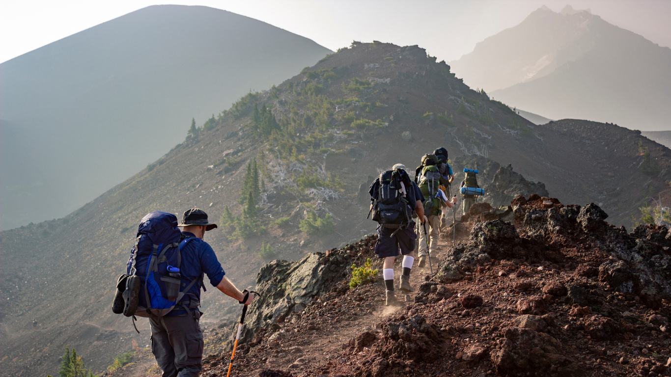
From Calenzana to Conca, the GR20 crosses Corsica in all its verticality. Over approximately 200 km and over 11,000 meters of elevation gain, it offers a unique adventure between steep peaks, granite ridges, pastoral valleys, and glacial lakes. Considered the most difficult long-distance hiking trail in France, it attracts seasoned hikers every year who come to experience the pure and challenging mountain scenery.
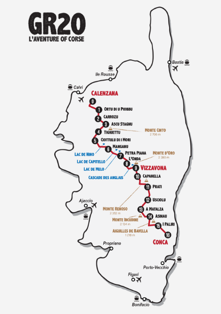
GR®20 route from Calenzana to Conca in 16 stages
The GR20, or Fra Li Monti, is an iconic trail that follows the spine of Corsica. From Calenzana in the north to Conca in the south, it crosses passes and valleys on a very rugged route. The route is generally divided into 16 stages, each lasting 4 to 8 hours, which corresponds to a walking time of 14 to 16 days, but some hikers complete it faster (7 days).
The northern part of the GR20, from Calenzana to Vizzavona, is particularly technical: rocky passages, slabs, ridges, and easy climbing areas. High-altitude lakes such as Capitellu and Melu punctuate this spectacular section. After the Vizzavona Pass, the south becomes gentler but remains demanding, with long ridges, forests, and the typical terrain of the center and south of the island. The path crosses the Usciolu sheepfolds, runs alongside the Aiguilles de Bavella, before plunging towards the coast and Conca, the end point of this great route.
Why do the GR®20? Between a sporting challenge and total immersion
The GR20 is much more than just a hiking trail, it’s a demanding and sensory journey through the heart of Corsica, an immersion in insularity, mountains, and effort. Here’s what makes it a unique route :
- Spectacular panoramas : unobstructed views of the sea, peaks, deep forests, and high-altitude lakes
- A complete sporting challenge : steep elevation changes, technical terrain, long stages, and the need for self-sufficiency
- Unspoiled nature : larici pine forests, beech groves, alpine pastures, waterfalls, and springs
- Iconic wildlife : mouflons, birds of prey, and endemic lizards found on the ridges
- Rustic yet authentic accommodation : mountain refuges, regulated bivouacs, Corsican sheepfolds
- An intense human experience : a spirit of mutual support among hikers, beneficial solitude, and self-improvement
Hiking the GR®20 means experiencing the Corsican mountains up close, in their most raw and noble form. Each step engages the body, mind, and emotions.
The must-see sites of the GR®20
The GR®20 is distinguished by the diversity and richness of its landscapes. Among the places not to be missed:
- Niolu, mountainous heart of Corsica
- Capu Tafunatu, famous holed summit visible from the GR
- The Capitellu and Melu lakes, vestiges of the ice age
- The Cascade des Anglais, emblematic place near Vizzavona
- The sheepfolds of Tolla, Usciolu or Onda, typical stops on the route
- The needles of Bavella, iconic rock formation of Southern Corsica
- The village of Conca, nestled below the last peaks
Each stage offers remarkable views, sometimes overlooking the valleys of the interior, sometimes overlooking the Mediterranean Sea visible on a clear day.
Connected routes and variants around the GR®20
The GR20 only crosses a few roads, but there are several connected routes in Corsica to modulate your adventure:
- North/South Sea : gentler east-west crossings
- Sea and Mountains : balcony trail, between sea and mountains
- Trails to Corte or Bavella : alternative routes to explore secondary valleys or create a loop
These connections make it possible to adapt the route, shorten the itinerary or supplement the GR20 with more accessible hikes.