Description
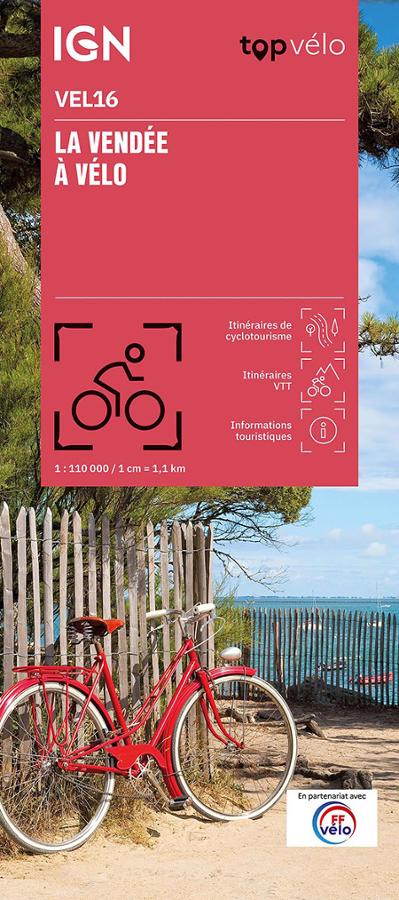
An IGN map for exploring the Vendée by bike
The IGN Vendée by bike map is ideal for planning your cycling trips in one of the most pleasant departments to explore by bicycle. Between beaches, marshes, forests, hedged farmland, islands, and charming villages, the Vendée offers a beautiful diversity of landscapes.
Thanks to its 1:110,000 scale, this map provides a clear view of the region. It allows you to locate routes, distances, access points, secondary roads, and main points of interest. It is therefore a useful tool for planning a day trip, a weekend getaway, or a longer stay.
The Vendée coast and inland areas in 46 routes
This map offers 46 cycling routes to discover the Vendée from different perspectives. It highlights major routes, regional tours, and routes suitable for various skill levels.
Cyclists can ride along the Atlantic coast, cross the marshes, reach charming villages, or venture inland. The map also allows you to compare routes based on their difficulty, distance, and duration.
The Vendée region is particularly well-suited to cycling. Its diverse routes are ideal for families as well as more experienced cyclists.
A practical paper tool for planning your routes
The IGN TOP Vélo VEL16 map is designed to simplify the planning of cycling trips. It helps visualize routes, possible variations, and connections between different areas of the department.
It is also very useful on the road. Used in conjunction with a GPS or app, it provides an overview. You can plan a stage, locate a village, find an alternative route, or extend your journey.
Finally, its folded format makes it easy to slip into a pannier or map case. It's a simple and effective companion for discovering the Vendée by bike, whether for a few hours or several days.
Key features:
- IGN TOP Cycling map dedicated to cycling in the Vendée
- Reference VEL16
- Scale 1:110,000
- Produced in partnership with the French Cycling Federation (FFvélo)
- 46 cycling routes to discover the coast and inland areas
- Routes classified by difficulty, distance, and duration
- Ideal for outings, weekends, and cycling holidays
- Major routes and regional tours indicated
- Good overview of the department
- Practical paper version to complement a GPS
FAQ
What area does the IGN Vendée by Bike map cover?
This map covers the Vendée department. It allows you to plan routes between the Atlantic coast, marshes, bocage (hedged farmland), villages, and the hinterland.
How many routes does this map offer?
The map offers 46 cycling routes, with routes classified by difficulty, distance, and duration.
Is this map suitable for families?
Yes. It allows you to choose routes according to your skill level and available time. It is therefore suitable for both families and more athletic cyclists.
What is the scale of this IGN map?
The scale is 1:110,000. This means that 1 cm on the map corresponds to 1.1 km on the ground.
Is this map suitable for a cycling holiday in the Vendée region?
Yes. It is very practical for planning a weekend or a cycling holiday in the Vendée, especially for exploring the coast, marshes, villages, and major cycling routes.
Features
Name
Map of the Vendée by bike - IGN TOP Vélo
Width
11.5 cm
Height
25 cm
Language
French
pubication
2025
Scale
1/110 000