Description
An ideal map encompassing coastline, islands, and marshes
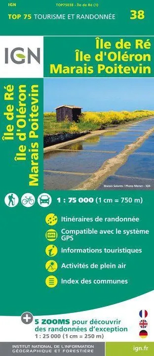
The IGN TOP75 Île de Ré, Île d’Oléron, and Marais Poitevin map covers an area particularly popular with hikers, cyclists, and curious travelers. It brings together three distinct landscapes: the open landscapes of Île de Ré, the forests and beaches of Île d’Oléron, and the peaceful canals of the Marais Poitevin.
This map is useful for planning a trip to Charente-Maritime, as well as for organizing excursions around La Rochelle, Rochefort, Marans, Saint-Martin-de-Ré, Saint-Pierre-d’Oléron, or Coulon.
Its 1:75,000 scale provides a broad overview of the region. This is practical for connecting different areas, choosing your stops, and identifying major access points before setting off.
Hiking, cycling, and exploring the Atlantic coast
This map is ideal for outdoor activities. It helps you plan walks, bike rides, family outings, or multi-day discovery itineraries.
On Île de Ré, it allows you to visualize villages, salt marshes, beach access points, and coastal routes. On Île d’Oléron, it helps you locate forests, harbors, trails, and secondary roads. In the Marais Poitevin, it becomes a valuable tool for understanding the layout of the canals, villages, and natural areas.
It also highlights information useful to travelers: roads, trails, points of interest, gentle terrain, natural areas, and tourist landmarks.
A practical map for planning your trip
The great advantage of this TOP75 map is that it covers a fairly large area without requiring multiple maps. It allows you to easily switch from a cycling trip on Île de Ré to a hike on Oléron, or a walk in the Marais Poitevin.
The five 1:25,000 scale extracts provide greater precision for certain areas. They are useful for planning a day hike or a more detailed outing.
Finally, this paper map perfectly complements a GPS track or a hiking guidebook. It provides an overview, helps in improvising alternative routes, and allows for a better understanding of the distances between sites.
Map Highlights:
- IGN TOP75 map dedicated to Île de Ré, Île d’Oléron, and the Marais Poitevin
- Main scale: 1:75,000
- 5 zoom levels: 1:25,000
- Ideal for hiking, cycling, sightseeing, and nature walks
- Very useful for planning a trip to the Charente coast
- Roads, trails, points of interest, and tourist information
- Areas covered: La Rochelle, Rochefort, Marans, Île de Ré, Île d’Oléron, and the Marais Poitevin
- Good overview for planning multiple stages
- Practical paper version to complement a GPS
FAQ
What area does this IGN TOP75 map cover?
It covers Île de Ré, Île d’Oléron, and the Marais Poitevin, with a broad view of the Charente coastline and neighboring natural areas.
Is this map suitable for cycling?
Yes. It helps identify roads, connections, trails, and areas easy to cycle, particularly on Ré, Oléron, and around the Marais Poitevin.
Can it be used for hiking?
Yes. It helps plan walks and hikes, providing a clear view of trails, natural areas, and access points.
What is the map scale?
The main scale is 1:75,000. This allows you to view a fairly large area on a single map.
Are the 1:25,000 zooms useful?
Yes. They provide more detail in certain areas and make it easier to plan short hikes or day trips.
Features
Name
IGN TOP 75 map Île de Ré – Île d'Oléron – Marais Poitevin
Width
11.5 cm
Height
25 cm
Weight
0.12 kg
Language
English, French, German
Type
Mountain Bike