Description
A guidebook for following the GR®736 along the Tarn River
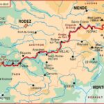
The Gorges and Tarn Valley – GR®736 guidebook accompanies hikers on one of the great trails of southern France. From Villefort, at the foot of Mont Lozère, the route follows the Tarn River to Albi.
The trail crosses three exceptional regions: the Cévennes, the Tarn Gorges, and the Grands Causses. The landscapes change with each stage. You'll pass from wooded hills to majestic canyons, then from open plateaus to charming villages.
This guide is ideal for planning a multi-day hike. It's also suitable for hikers who only want to explore a section of the GR®736.
More than 15 days of hiking between Villefort and Albi
The GR®736 is approximately 310 km long. It can be completed in 15 days, depending on your pace. First, the trail leaves Villefort and enters the landscapes of Mont Lozère. Then, it follows the Tarn River towards the gorges, the limestone plateaus, and the more open valleys.
Along the way, there are many remarkable sites. The route allows you to discover Sainte-Enimie, Peyre, the Tarn Gorges, the Grands Causses, the Millau Viaduct, and the Ambialet loop. Finally, the hike ends in Albi, a heritage city with pink and ochre hues.
Moreover, the GR®736 offers a beautiful diversity of atmospheres. It is a route that is at once natural, rich in heritage, and truly unique
.
A practical guide for planning your hike
This FFRandonnée guidebook helps you prepare each stage. It allows you to follow the route, anticipate distances, and find useful information for your trip.
In practice, it is particularly suited to hikers who want to walk for several days. However, it also offers a selection of 3-day hikes, ideal for long spring or autumn weekends.
Finally, this second edition, published in 2026, provides an up-to-date guidebook. It's a reliable companion for exploring the Tarn Gorges and Valley on foot.
Guidebook Highlights:
- Guidebook dedicated to the GR®736
- Route from Villefort to Albi
- Approximately 310 km of hiking
- 15 days of trekking
- Crossing the Cévennes, the Tarn Gorges, and the Grands Causses
- Passing through remarkable sites: Sainte-Enimie, Peyre, Millau, Albi
- Varied landscapes: canyons, plateaus, valleys, villages, and the banks of the Tarn River
- Selection of 3-day hikes
- Ideal for long spring and autumn weekends
- FFRandonnée Guidebook, 2nd edition 2026
FAQ
What route does this GR®736 guidebook cover?
This guidebook covers the GR®736 – Tarn Gorges and Valley. It connects Villefort to Albi, following the Tarn River.
How many days does it take to hike the GR®736?
The complete route takes approximately 15 days to hike. It covers about 310 km.
What landscapes does the GR®736 cross?
The trail crosses the Cévennes mountains, the Tarn gorges, and the Grands Causses plateaus. It offers landscapes of canyons, plateaus, valleys, villages, and wild riverbanks.
Is it possible to hike only a section of the GR®736?
Yes. The guidebook also offers suggestions for 3-day hikes. This is ideal for a long weekend or a first-time experience of the trail.
Is this guidebook suitable for a multi-day hike?
Yes. It is designed to help you plan a multi-day trek. It helps you organize your stages, follow the route, and discover points of interest along the way.
Features
Name
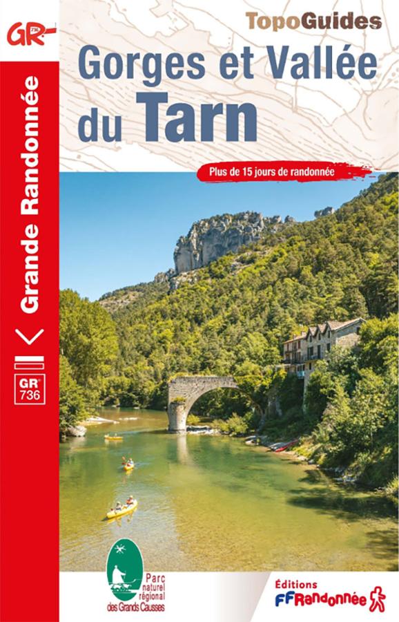
Topoguide GR®736 – Gorges et Vallée du Tarn, de Villefort à Albi
Weight
0.22 kg
Language
French
Type
Guide, Topoguide