Description
A detailed map for exploring Lake Constance
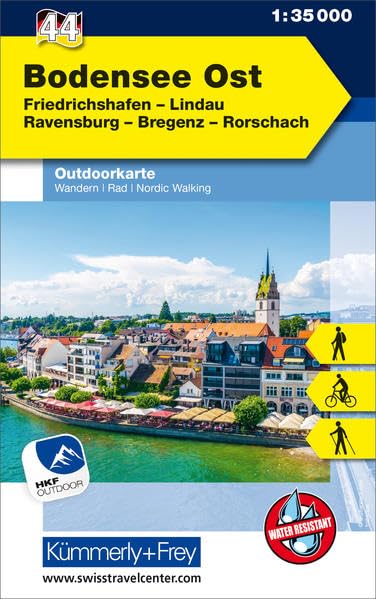
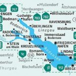
The Kompass map no. 11 Bodensee accompanies hikers and travelers around Lake Constance. Also known as Bodensee, this large alpine lake offers numerous opportunities for walks, hikes, and bike rides.
This map makes it easy to plan your routes. It helps you locate trails, roads, bike paths, villages, viewpoints, and must-see tourist attractions.
Thanks to its 1:35,000 scale, the map offers a high level of precision. It remains legible while covering a large area. It is therefore a useful tool for planning an active stay around the lake.
Hiking, cycling, and sightseeing
This Kompass map set is suitable for outdoor activities. It allows you to plan day hikes, shorter walks, or bike rides around Lake Constance.
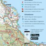
Furthermore, the map shows official hiking trails, cycle paths, accommodations, parking areas, train stations, public transport stops, and numerous points of interest. This allows you to better plan your stages and access routes.
Lake Constance is a popular destination thanks to its stunning scenery of water, mountains, and historic towns. Along the way, you can discover Constance, Mainau Island, Bregenz, the Pfänder region, and many lakeside villages.
A practical set of 2 maps for the field
This product includes two hiking maps. This is a real advantage for covering the entire Lake Constance area without sacrificing precision.
The map is also designed for use in the field. It easily fits in a backpack or pannier. Additionally, the mapped area is available offline in the Kompass app, subject to the publisher's terms and conditions.
Finally, this map is ideal for travelers looking for a reliable resource to plan a nature-filled trip around Lake Constance. It will be particularly useful for hikers, cyclists, and outdoor enthusiasts.
Map Highlights:
- Set of 2 Kompass maps dedicated to Lake Constance
- Accurate 1:35,000 scale
- Ideal for hiking, cycling, and outdoor activities
- Official hiking trails marked
- Cycle paths and bike routes shown
- Points of interest marked
- Relief, contour lines, and natural features
- Useful information: train stations, parking lots, accommodations, mountain huts
- Map usable offline in the Kompass app
- 2024 Edition
FAQ
What area does Kompass Map No. 11 Bodensee cover?
This map covers the Lake Constance area, also known as Bodensee. It is ideal for planning hikes, bike rides, and sightseeing trips around the lake.
Is this map suitable for hiking?
Yes. It shows official hiking trails, terrain, contour lines, points of interest, and useful information for planning a hike.
Can this map be used for cycling around Lake Constance?
Yes. The map also shows cycle paths and cycling routes. It can therefore be used to plan bike rides or stages around Lake Constance.
Is the map in French?
The map's primary language is German. However, the cartography, pictograms, and visual information are still useful for planning your route.
Is the map available in digital format?
According to the publisher, the mapped area can be used offline in the Kompass app. It is advisable to check the activation details provided with the map.
Features
Name
Kompass Map No. 11 Lake Constance / Bodensee – Set of 2 maps
Weight
0.174 kg
Language
German
pubication
2024
Scale
1/35 000