
Description
An IGN map to discover the Camargue and the Alpilles
The IGN TOP 75 Camargue – Alpilles map is a practical tool for exploring two iconic regions of southern France: the vast natural landscapes of the Camargue and the limestone hills of the Alpilles. It notably covers the areas of Saintes-Maries-de-la-Mer and Les Baux-de-Provence, two must-see destinations for hiking, discovering Provençal heritage, or planning nature walks.
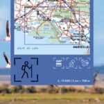
With its 1:75,000 scale, this map offers a comprehensive overview of the region, ideal for planning a trip, locating access points, identifying villages, local roads, and key natural and cultural sites. It is suitable for hikers, cyclists, and travelers who want to explore the region with a reliable paper map.
Hiking, cycling, and heritage in Provence
IGN TOP 75 maps are designed for outdoor enthusiasts and those interested in heritage discovery. This map helps you locate the road network, hiking trails, GR® and GR® de Pays long-distance footpaths, as well as points of tourist interest: viewpoints, remarkable buildings, natural sites, villages, museums, and monuments.
It is particularly useful for planning a hike in the Camargue, a walk around the Alpilles mountains, a bike ride between Provençal villages, or exploring the landscapes of marshes, plains, ponds, rocky outcrops, and historical heritage.
Contour lines, elevation markers, and terrain features allow you to assess the difficulty of the routes, especially in the Alpilles. In the Camargue, the map helps you visualize the wide open spaces, access roads, natural areas, and routes suitable for outdoor activities.
TOP 25 zooms for noteworthy areas
The map includes extracts of more precise 1:25,000 scale maps for planning one- or two-day hikes in the most interesting areas. These TOP 25 zoom maps offer a level of detail particularly useful for hikers who want to orient themselves more precisely on the terrain.
Thanks to its GPS grid, this map also allows you to plot a position provided by a GPS device and better orient yourself during your hike. It therefore represents an excellent compromise between a tourist map, a hiking map, and a planning map for a nature-filled stay in Provence.
Map Highlights
- IGN TOP 75 map dedicated to the Camargue and the Alpilles
- Includes Les Baux-de-Provence and Saintes-Maries-de-la-Mer
- Main scale: 1:75,000
- TOP 25 zooms at 1:25,000
- Suitable for hiking, cycling, and outdoor activities
- Complete road network: main, secondary, and local roads
- Hiking trails, GR® and GR® de Pays trails
- Contour lines and elevation points to assess the terrain
- Tourist and cultural information
- GPS grid for easy navigation
FAQ
What area does the IGN TOP 75 Camargue – Alpilles map cover?
This map covers the Camargue and Alpilles regions, including Saintes-Maries-de-la-Mer and Les Baux-de-Provence.
Is this map suitable for hiking?
Yes, it's designed for outdoor activities. It shows trails, GR® (long-distance hiking trails), GR® de Pays (regional long-distance hiking trails), contour lines, landmarks, and other useful information for planning a hike.
Can this map be used to plan bike rides?
Yes, it shows the complete road network and allows you to plan cycling routes by identifying local roads, access points, villages, and key points of interest.
What's the difference between a TOP 75 map and a TOP 25 map?
The TOP 75 map offers a broader view of the area with a scale of 1:75,000. TOP 25 maps are more detailed, also at a scale of 1:25,000. This TOP 75 map includes TOP 25 zoom features for the most remarkable areas.
Is this map sufficient for visiting the Camargue and the Alpilles?
It's very useful for planning hikes and sightseeing trips. For a very precise hike in a small area, it can be supplemented by a local IGN TOP 25 map.
Features
Name
Camargue - Alpilles - carte IGN TOP75
Weight
0.11 kg
Language
French
Publishers
IGN