


Document très lisible, beaucoup de renseignements (camping, resto..) format et pliage intéressant
Description
The Danube by bike and EuroVelo 6: 7 maps for cycling from Basel to Budapest
2024 Edition. 7 maps in a laminated protective cover introduce you to EuroVelo 6, between Basel and Budapest. The maps are specially designed for cycle tourists:
- 1:100,000 scale
- Lightweight and easy to fold
- Cycle routes (cycle path, secondary road, alternative)
- Practical points of reference (repair shops, information centres, accommodation, restaurants, etc.)
- Tourist attractions (museums, UNESCO sites, gardens, parks, viewpoints, monuments, etc.)
- Legend in English and German
This pack is the second in a series of 3, covering the whole of EuroVelo 6, from the Atlantic to the Black Sea.
Stages and sections of EuroVelo 6 by map :
- Map 1: Basel, Stein am Rhein, Lake Constance, Radolzell
- Map 2: Radolzell, Tuttlingen, Donaueschingen, Ulm
- Map 3: Ulm, Regensburg
- Map 4: Regensburg, Passau
- Map 5: Passau, Linz, Wachau
- Map 6: Wachau, Wien, Bratislava
- Map 7: Bratislava, Budapest
Features
Name
Rhine and Danube by Bike, Pack of 7 Maps - Eurovelo 6 from Basel to Budapest
Weight
0.295 kg
Eurovelo
Eurovelo 6
Language
English, German
Publishers
Huberverlag
Scale
1/100 000
Type
Map
Customer Review
Florence D
Michel F
Il manque une légende pour interpréter tous les chiffres qui apparaissent sur ces cartes.
Christine A
Manque les distances entre les principales villes. Modérateur : C’est exact, ces informations manquent, nous faisons remonter l’information !
Pierre P
Ces cartes ne comportent pas d’indications de kilométrage liées aux voies de vélo. Cela rend difficile la préparation des itinéraires.
Dominique D
Bonnes cartes, mais pourquoi n’y a-t-il pas les kilomètres???
Catherine L
très belles cartes mais il n’y a pas de kilométrage entre les villes ou bourgs importants .
Julien M
De belles cartes, je note qu’en effet les distances ne figurent pas sur les axes ce qui est dommage et oblige à emporter un curvimètre !
Patrick H
Il ne me reste plus qu’à rejoindre le Bodensee (j’ai déjà fait « Atlantique-Konstanz »avec les cartes de la maison « HUBER »). Cartes très claires. C’est prévu pour ce printemps, mais covid et tension sur le front de l’Est me retienne un peu. l’Envoi a été très rapide. Cordialement Patrick H.
Karlheinz M
Bonjour, Bon rapport qualité/prix: Les cartes correspondent à mes besoins.
Dominique A
Carte très utile sur le parcours, d’autant plus que je ne me sers pas de GPS. Il y a malheureusement eu quelques changements sur le terrain, pas toujours très heureux d’ailleurs. Il y a des campings en plus de ceux indiqués et des signes campings où il n’y en a pas ou plus ou dans des endroits où l’on ne peut pas laisser ses affaires en sécurité sans surveillance.
Robert T
Très satisfait de ces cartes, toutefois il manque les distances entre les agglomérations.
jean luc R
KM inexistant donc difficile de planifier des endroits de repo
BRUNO T
Merci à vous pour votre efficacité ! La commande est arrivée rapidement et bien emballée.
Patrick B
conforme au descriptif
Serge B
Précis. Format adapté. Il ne reste plus qu’à inscrire le tracé choisi sur le support. Je recommande.
This might interest you
Similar Products
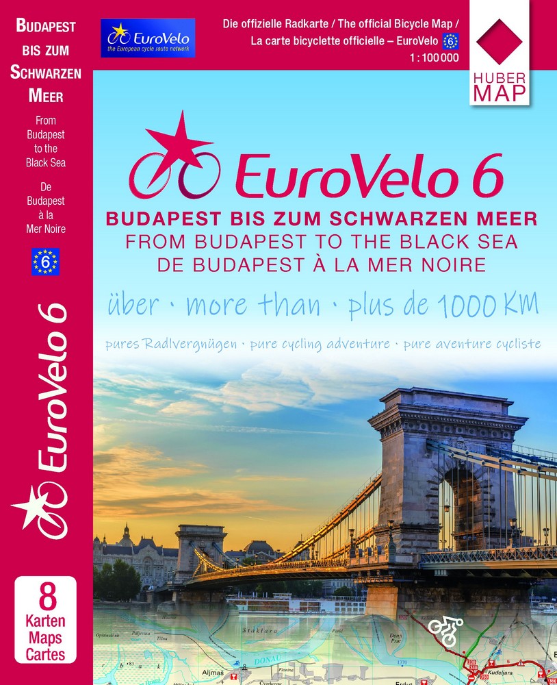
EuroVelo 6 cycle map – Budapest to the Black Sea
Prepare your EuroVelo 6 trip from Budapest to the Black Sea with this set of detailed maps dedicated to the final major section of the Danube by bike. From Hungary to Romania, passing through Serbia and Bulgaria, these maps guide cyclists along a legendary route that winds through the river, historic cities, villages, the Danube plains, and the Black Sea.
25,90€
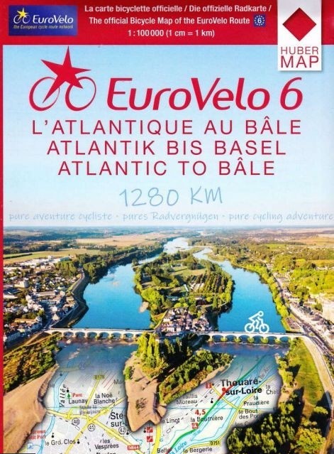
EuroVelo 6 maps - from the Atlantic to Basel by bike
Plan your EuroVelo 6 journey from the Atlantic to the Rhine with this set of six detailed cycling maps. From the Atlantic coast to Basel, the route follows, among other places, the Loire à Vélo, Burgundy à Vélo, the Doubs Valley, and the Rhône-Rhine Canal. At a scale of 1:100,000, these maps are ideal for planning a long-distance cycling trip in France.
24,95€