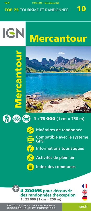
Description
An IGN map to discover the Mercantour
The IGN TOP 75 Mercantour map is ideal for planning a nature getaway in the Southern Alps. It offers a comprehensive overview of the Mercantour massif and National Park.
Thanks to its 1:75,000 scale, it allows you to visualize roads, access routes, valleys, hiking trails, and the main tourist attractions. It is therefore suitable for hikers, cyclists, and travelers who wish to explore the region.
This map is particularly useful for organizing a trip, planning day trips, or identifying areas to explore before choosing a more detailed map.
Hiking, cycling, and outdoor activities
The Mercantour is an exceptional mountain region. It features wild valleys, high-altitude lakes, mountain passes, perched villages, and iconic trails.
This map helps you locate hiking routes, outdoor activities, and useful tourist information. Furthermore, the index of municipalities makes it easy to find a village, a starting point, or a specific area.
The map is also ideal for planning cycling routes. It helps visualize roads, terrain, valleys, and connections between the different areas of the mountain range.
5 TOP 25 zooms for exceptional hikes
The real advantage of this map is the inclusion of five 1:25,000 zooms. These sections offer a higher level of detail for planning hikes in remarkable locations.
They are particularly useful for better understanding trails, contour lines, and terrain features. Among the highlighted areas is the Vallée des Merveilles (Valley of Wonders), an iconic site in the Mercantour National Park.
Finally, the map is compatible with GPS systems. This allows you to combine the printed information with digital navigation, making it easier to plan your outings.
Map Highlights:
- IGN TOP 75 map dedicated to the Mercantour National Park
- Main scale: 1:75,000
- 5 hiking zooms at 1:25,000
- Ideal for hiking, cycling, and outdoor activities
- Marked hiking trails
- Detailed tourist information
- Relief, valleys, roads, and access points depicted
- Index of towns and villages
- GPS compatible
- Overview of the Mercantour National Park and mountain range
FAQ
What area does the IGN TOP 75 Mercantour map cover?
This map covers the Mercantour National Park and is ideal for planning outings in the Southern Alps, particularly around the Mercantour National Park.
Is this map suitable for hiking?
Yes. It shows hiking trails and includes 5 zooms at 1:25,000 for notable areas. For a very specific hike, it can be supplemented with a local IGN TOP 25 map.
Can this map be used for cycling?
Yes. Its 1:75,000 scale allows you to visualize roads, valleys, access points, and terrain. It is therefore useful for planning cycling trips or routes in the Mercantour National Park.
What is the difference between a TOP 75 and a TOP 25 map?
The TOP 75 map provides a broader view of the area. It is practical for planning a trip or identifying several areas. The TOP 25 map is more detailed and better suited for precisely tracking a hike in the field.
Does the map contain detailed zooms?
Yes. It includes five 1:25,000 zooms to discover exceptional hikes in the Mercantour National Park.
Features
Name
IGN TOP 75 Mercantour Map – Hiking and Cycling
Weight
0.15 kg
Language
French
pubication
2017
Scale
1/75 000