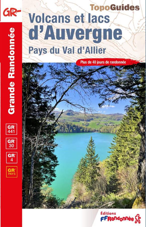
Description
A Complete Guidebook for Hiking in Auvergne
The Volcanoes and Lakes of Auvergne guidebook accompanies hikers through the heart of the Auvergne Volcanoes Regional Natural Park. It includes several major routes, such as the GR®441, GR®30, GR®4, and GR® de Pays trails.
This guide allows you to discover the most beautiful volcanic landscapes of Auvergne. It features the Chaîne des Puys mountain range, high-altitude lakes, valleys, plateaus, and villages of the Massif Central.
This guidebook is for hikers planning a long-distance trek. It is also suitable for those who want to hike in sections, over a few days or a long weekend.
GR®441, GR®30, GR®4, and the Allier Valley
The GR®441 loops around the Chaîne des Puys in 6 days, covering approximately 117 km. It offers stunning views of the Puy de Dôme, the Puy Chopine, and the surrounding volcanic landscapes.
The GR®30, meanwhile, allows you to hike around the Auvergne lakes in 9 days, covering approximately 198 km. It's an ideal route for discovering landscapes shaped by volcanoes and glaciers.
In addition, the GR®4 crosses the Auvergne Volcanoes Regional Natural Park in 8 days, from Égliseneuve-d'Entraigues to Crocq. Finally, the GR® de Pays du Val d'Allier offers 5 loops of 3 to 5 days, with sections at the gateway to the Livradois-Forez region.
A practical guide to planning your hike
This FFRandonnée guidebook is designed to help you precisely plan your stages. It allows you to choose your route according to your fitness level, available time, and desired scenery.
In practice, it's useful for planning a multi-day hike. However, the routes are also flexible. You can therefore choose a loop, a section of the GR® trail, or a shorter itinerary, depending on your preferences.
Finally, this new 2026 edition provides an updated guidebook. It's a reliable resource for exploring the volcanoes, lakes, and valleys of Auvergne on foot.
Guidebook Highlights:
- Over 40 days of hiking in Auvergne
- 5 routes in the heart of the Auvergne Volcanoes Regional Natural Park
- GR®441: Tour of the Chaîne des Puys in 6 days
- GR®30: Tour of the Auvergne Lakes in 9 days
- GR®4: Crossing the Regional Natural Park in 8 days
- GR® de Pays du Val d’Allier with 5 loops of 3 to 5 days
- Volcanic landscapes, lakes, plateaus, and valleys
- Itineraries that can be broken down and adapted
- FFRandonnée Guidebook, 9th edition 2026
- A reference for hiking in Auvergne
FAQ
Which routes does this guidebook cover?
This guidebook covers several major routes in Auvergne: the GR®441, the GR®30, the GR®4, and GR® de Pays trails, particularly around the Val d’Allier.
How many days of hiking does this guidebook offer?
This guidebook covers more than 40 days of hiking. The routes can be hiked in their entirety or in sections.
Does this guidebook allow you to hike around the Chaîne des Puys?
Yes. It describes the GR®441, which circles the Chaîne des Puys in 6 days, covering approximately 117 km.
Is this guidebook suitable for short trips?
Yes. Several routes can be broken down into shorter sections. The loops of the GR® de Pays du Val d’Allier, in particular, can be hiked in 3 to 5 days.
What landscapes can you discover with this guidebook?
The guidebook allows you to discover the Chaîne des Puys, the lakes of Auvergne, the volcanic plateaus, the valleys, the Val d’Allier, and the gateway to the Livradois-Forez region.
Features
Name
Volcanoes and lakes of Auvergne - Pays du Val d'Allier
Length
13.50 cm
Width
1 cm
Height
21 cm
Weight
0.310 kg
Language
French
Type
Guide, Topoguide
This might interest you
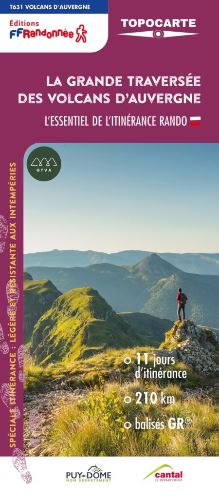
FFRP map- The great crossing of the Auvergne volcanoes
Explore the Sancy massif, the Artense plateau, the Cézallier massif and the Puy Mary. 210km in the heart of the Auvergne Volcanoes, 11 days of roaming, breathtaking landscapes, an unforgettable journey.
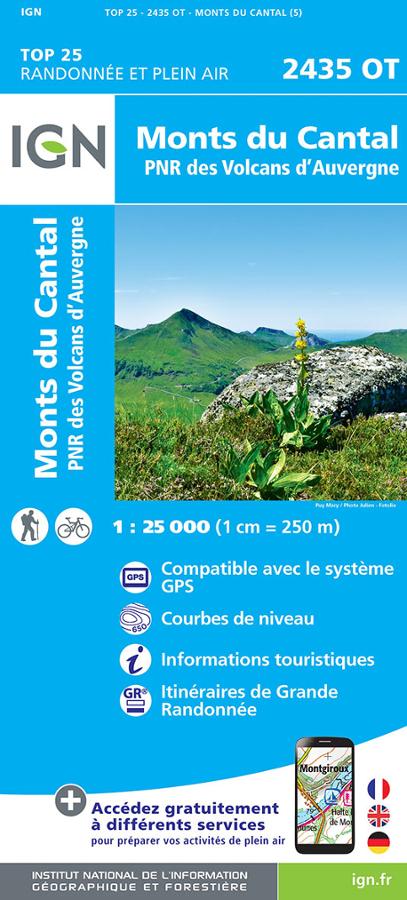
Monts du Cantal et PNR des Volcans d'Auvergne - IGN TOP 25
Carte IGN TOP 25 Randonnée et plein air 2435 OT sur les Monts du Cantal et PNR des Volcans d'Auvergne avec itinéraires de grande randonnée et informations touristiques.